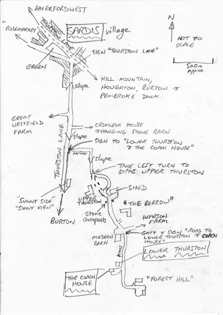
How to Find Us
Find us at this Streetmap link, or Google Maps.
For those using the What3words app, the location is ///mobile.roofed.establish .
The address for your satnav is Lower Thurston, Thurston Lane, Sardis, Milford Haven, Pembrokeshire, SA73 1LD. Your satnav may take you to the nearest place on the public highway of Thurston Lane; however we are located half a mile down a (sometimes bumpy) private lane.
If you are approaching from the east via the M4, then we are about 2.5 hours from the Severn Bridge. Traffic can get heavy on a Friday evening on the M4 in South Wales, so allow some time for this. It is normally about the same driving time on the southerly route via Pembroke Dock, compared to the northerly route via Haverfordwest (we are about halfway between Pembroke Dock and Haverfordwest), but the southern route is recommended due to lighter traffic and more dual lane sections.
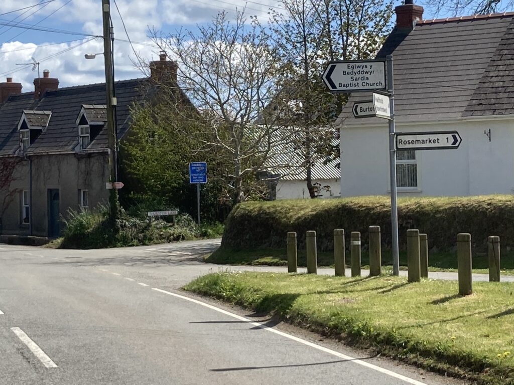
Whichever route you take, it is best to stay on the old Pembroke main road (the C3007) running between Burton near the Cleddau Bridge, and the Merlin’s Bridge roundabout in Haverfordwest, and head for the small village of Sardis on this road; many of the nearby single-track country lanes (around Rosemarket) are narrow and tortuous. Once in Sardis, take the small side road marked “Thurston Lane” at the “pointy” end of the small triangular village green (if approaching from Haverfordwest, this is on the right, 50 yards AFTER the large right turn to Rosemarket).
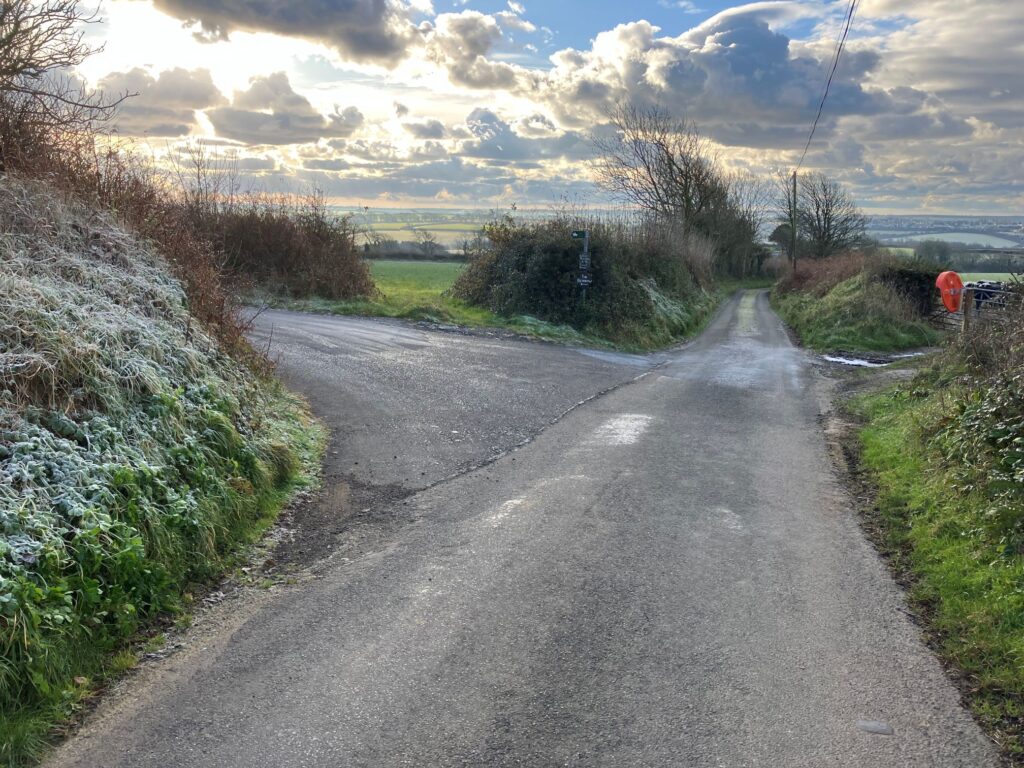
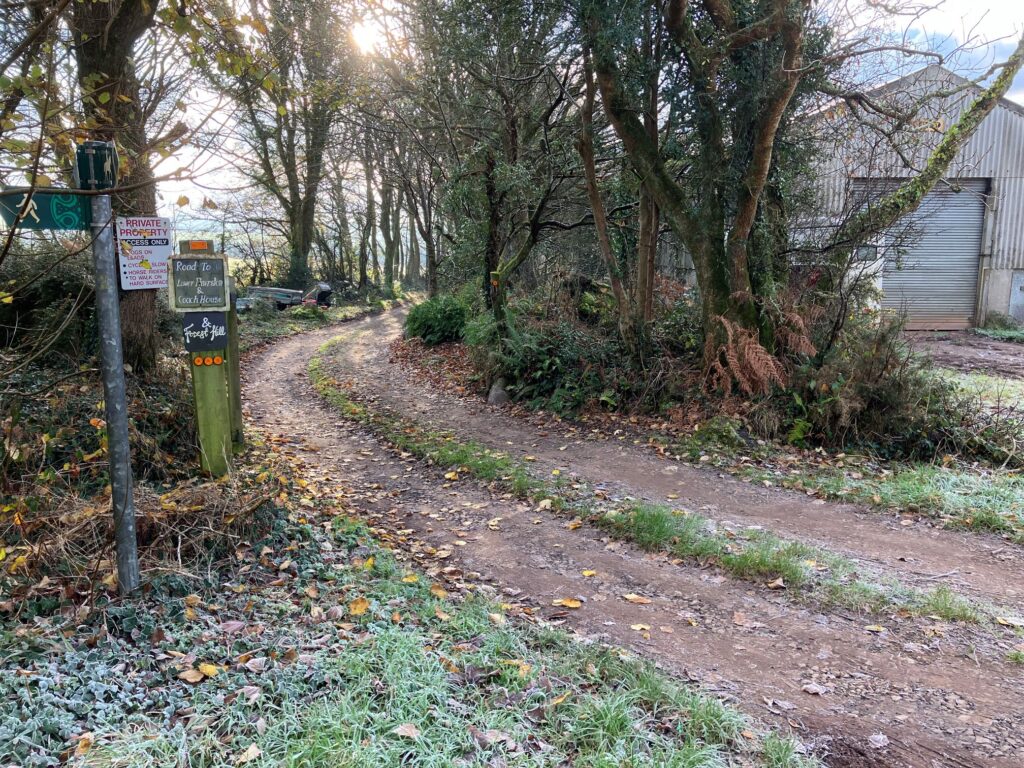
Once on Thurston Lane, continue up and over the low brow of the hill, passing the entrance to Cromlech House on the left. Continue another 200 yards down the hill to a macadamed turning on the left; you’ll see a sign on a post to “Lower Thurston & The Coach House”. You’ll also see an orange road mirror on the right.
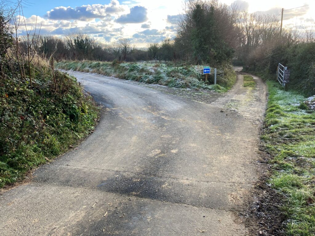
Take this turning and follow down the hill for half a mile. The road has sharp corners and bends, and is used by walkers, neighbours with children, horse-riders, cyclists, farm traffic, and occasionally foxes, badgers and even ducks – please take care – we suggest a maximum speed of 15mph. On the tarmac section, there’s a speed hump at each of the two corners. At the bottom of the initial narrow sunken lane is a junction – take the left turn onto the gravel road to bypass Upper Thurston Farmhouse.
Carry on around the curve through the field, and keeping left at the next junction. Continue past a shed with blue doors, and stacks of wood, on the left.
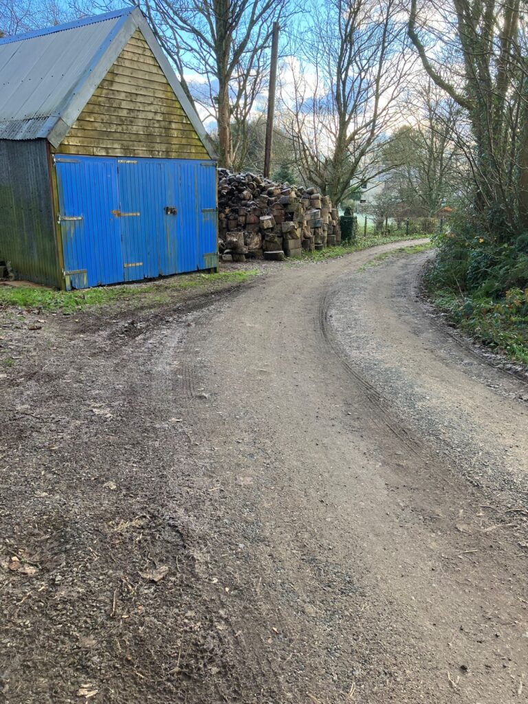
Then past a modern house on the left “The Berrow”; 50 yards further on there is a modern large barn on the right, and our entrance gate straight on (to the left of the barn). There’s a sign on the gatepost for Lower Thurston & Coach House. Just before our gate is a shallow dip, with occasional rain run-off from the fields – take it easy through the dip.
Drive on down our bendy road through the trees until you see a house on the right (this is Lower Thurston main house).
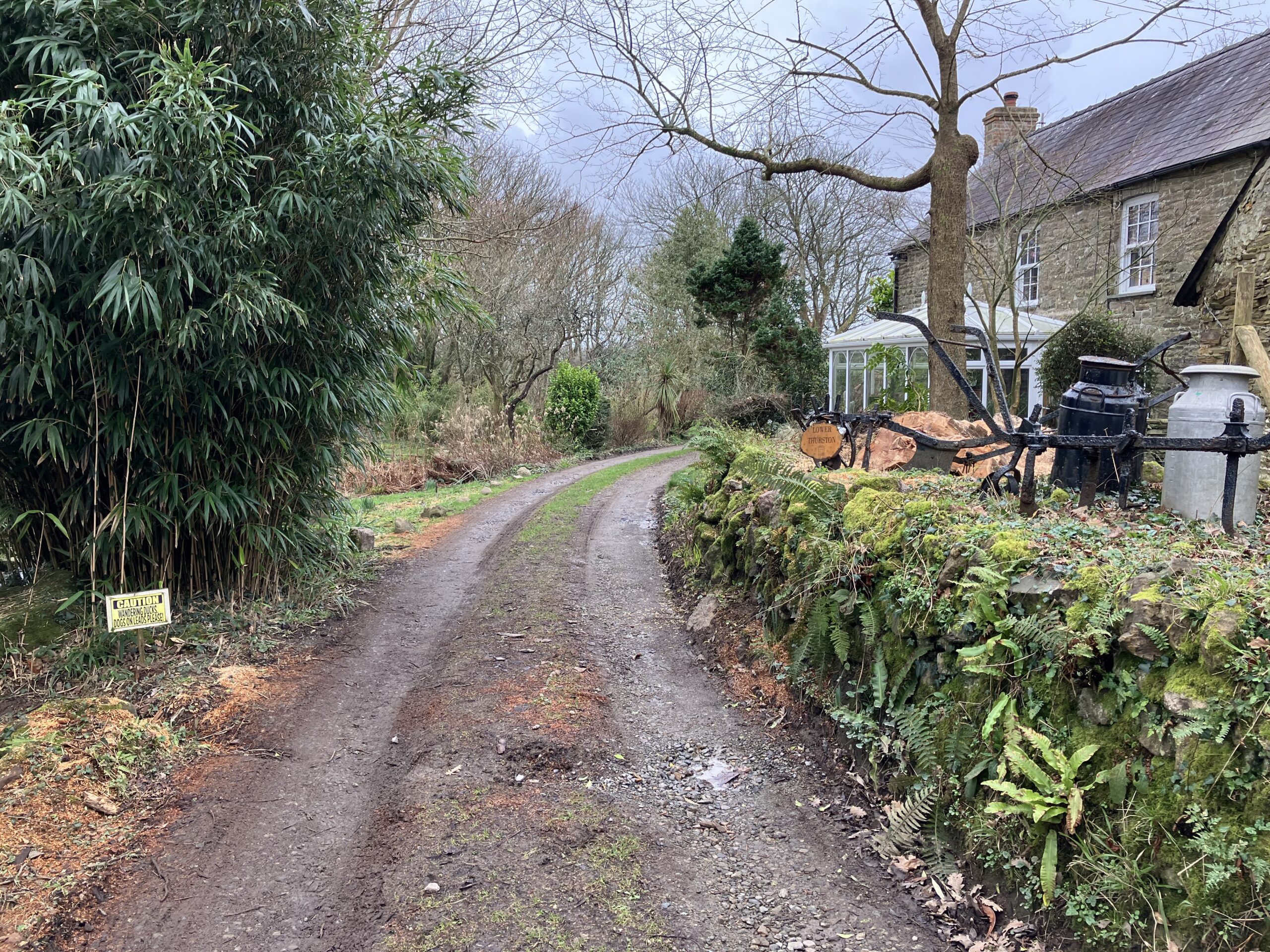
Just past this there’s a yard on the right with The Coach House facing this yard; park on the left side of the yard. If you reach the end of the road in the next smallholding “Forest Hill”, you’ve gone too far, turn around and come back!